Lowell, Massachusetts, Hgh State Clinic, Hgh Injections, Hrt Doctors
Lowell, Massachusetts Blood Testing Facilities
 Represents a LabCorp blood testing facility
 Represents a Quest Diagnostics blood testing facility
Nearby Labcorp Blood Testing facilities:
- Labcorp Center Distance: 10 m, 25 Pelham Rd Ste 103A, Salem, Rockingham County, NH, 3079
- Labcorp Center Distance: 11 m, 49 Range Rd Ste 101, Windham, Rockingham County, NH, 3087
- Labcorp Center Distance: 12 m, 380 Merrimack St Ste B2, Methuen, Essex County, MA, 1844
- Labcorp Center Distance: 18 m, 6 Lexington St 2Nd Floor, Waltham, Middlesex County, MA, 2452
- Labcorp Center Distance: 22 m, 1400 Centre St Ste 208 2Nd Fl, Newton Center, Middlesex County, MA, 2459
- Labcorp Center Distance: 23 m, 101 Riverway Pl, Bedford, Hillsborough County, NH, 3110
- Labcorp Center Distance: 31 m, 19 Hampton Rd Ste 13, Exeter, Rockingham County, NH, 3833
- Labcorp Center Distance: 33 m, 140 W Boylston Dr, Worcester, Worcester County, MA, 1606
- Labcorp Center Distance: 35 m, 21 Eastern Avenue Suite G2, Worcester, Worcester County, MA, 1605
- Labcorp Center Distance: 38 m, 966 Park St Unit B7, Stoughton, Norfolk County, MA, 2072
- Labcorp Center Distance: 39 m, 875 Greenland Rd Orchard Park, Portsmouth, Other, NH, 3801
- Labcorp Center Distance: 40 m, 230 Lafayette Rd Bldg D, Portsmouth, Rockingham County, NH, 3801
- Labcorp Center Distance: 45 m, 750 Central Ave Ste E, Dover, Strafford County, NH, 3820
- Labcorp Center Distance: 47 m, 72 Cudworth Rd, Webster, Worcester County, MA, 1570
- Labcorp Center Distance: 49 m, 40 Winter St Ste 200, Rochester, Strafford County, NH, 3867
- Labcorp Center Distance: 57 m, 756 Eddy St Suite 101, Providence, Providence County, RI, 2903
- Labcorp Center Distance: 85 m, 12 Case St Ste 302, Norwich, New London County, CT, 6360
- Labcorp Center Distance: 96 m, 2284 Berlin Turnpike, Newington, Hartford County, CT, 6111
Nearby Quest Blood Testing facilities:
- Quest Center Distance: 2 m, 700 Rogers Street, Lowell, Middlesex County, MA, 01854-3571
- Quest Center Distance: 3 m, 39 Village Square, Chelmsford, Middlesex County, MA, 01824-2743
- Quest Center Distance: 9 m, 45 Stiles Rd Ste 102, Salem, Rockingham County, NH, 03079-2850
- Quest Center Distance: 10 m, 300 Main St, Nashua, Hillsborough County, NH, 03060-4635
- Quest Center Distance: 16 m, 62 Brown Street, Haverhill, Essex County, MA, 01830-6790
- Quest Center Distance: 17 m, 22 Mill Street, Suite 107, Arlington, Middlesex County, MA, 02476-4738
- Quest Center Distance: 20 m, 180-182 Endicott Street, Danvers, Essex County, MA, 01923-0000
- Quest Center Distance: 22 m, 1180 Beacon St Ste 1D, Brookline, Norfolk County, MA, 02446-3885
- Quest Center Distance: 23 m, 79 Erdman Way, Leominster, Worcester County, MA, 01453-0000
- Quest Center Distance: 25 m, 61 Lincoln St, Framingham, Middlesex County, MA, 01702-8264
- Quest Center Distance: 32 m, 500 Congress St Ste 1E, Quincy, Norfolk County, MA, 02169-0908
- Quest Center Distance: 33 m, 335 Morse St, 1St Floor, Norwood, Norfolk County, MA, 02062-5034
- Quest Center Distance: 35 m, 100 Mlk, Jr. Blvd, Worcester, Worcester County, MA, 01608-1220
- Quest Center Distance: 37 m, 851 Main Street, S. Weymouth, Norfolk County, MA, 02190-2409
- Quest Center Distance: 39 m, 200 Griffin Rd Unit 12, Portsmouth, Rockingham County, NH, 03801-7114
- Quest Center Distance: 40 m, 10 Commercial St, Foxboro, Norfolk County, MA, 02035-2509
- Quest Center Distance: 41 m, 210 Quincy Ave, Brockton, Plymouth County, MA, 02302-2864
- Quest Center Distance: 53 m, 391 West Street, Keene, Cheshire County, NH, 03431-0000
- Quest Center Distance: 55 m, 1 Randall Sq, Providence, Providence County, RI, 02904-2709
- Quest Center Distance: 59 m, 57 Long Pond Rd, Plymouth, Plymouth County, MA, 02360-2670
- Quest Center Distance: 61 m, 14 Country Club Rd, Gilford, Belknap County, NH, 03249-6907
- Quest Center Distance: 64 m, 101 President Ave, 1St Floor, Fall River, Bristol County, MA, 02720-2652
- Quest Center Distance: 68 m, 106 Main Street, Wareham, Plymouth County, MA, 02571-2122
- Quest Center Distance: 71 m, 237 State Rd, North Dartmouth, Bristol County, MA, 02747-2612
- Quest Center Distance: 76 m, 135D Storrs Rd, Mansfield Center, Tolland County, CT, 06250-1638
- Quest Center Distance: 78 m, 100 Hazard Ave, Enfield, Hartford County, CT, 06082-5447
- Quest Center Distance: 81 m, 520 Hartford Turnpike, Vernon, Tolland County, CT, 06066-0000
- Quest Center Distance: 82 m, 350 Gifford St Ste 15-17, Falmouth, Barnstable County, MA, 02540-2918
- Quest Center Distance: 84 m, 2 Concorde Way, Building 3A, Windsor Locks, Hartford County, CT, 06096-1577
- Quest Center Distance: 85 m, 55 Town Street, Norwich, New London County, CT, 06360-2332
- Quest Center Distance: 86 m, 69 Camp Street, Hyannis, Barnstable County, MA, 02601-0000
- Quest Center Distance: 89 m, 229 Cranberry Hwy, Orleans, Barnstable County, MA, 02653-3272
- Quest Center Distance: 90 m, 253 Pleasant Lake Ave, W. Harwich, Barnstable County, MA, 02645-2535
- Quest Center Distance: 91 m, 131 New London Turnpike, Glastonbury, Hartford County, CT, 06033-2246
- Quest Center Distance: 92 m, 100 Retreat Ave, Hartford, Hartford County, CT, 06106-2528
- Quest Center Distance: 93 m, 381 Hopmeadow Street, Simsbury, Hartford County, CT, 06089-9692
- Quest Center Distance: 94 m, 465 Silas Deane Highway, Wethersfield, Hartford County, CT, 06109-2134
- Quest Center Distance: 97 m, 721 Bank Street, New London, New London County, CT, 06320-5005
- Quest Center Distance: 99 m, 15 Chesterfield Road, East Lyme, New London County, CT, 06333-1730
Massachusetts Hormone Replacement Therapy Solutions
The Conscious Evolution Institute is Massachusetts' best source for twenty-first century Hormone Optimization and Restoration. We serve every corner of Massachusetts, and we can even meet you at your home or business in order to perform the evaluation necessary to make an informed diagnosis on your behalf.
With our assistance, we can help you mitigate or overcome the pitfalls of hormone imbalance, improving your health and wellness and increasing the odds that you live a longer and happier life.
Massachusetts HGH Therapy
One of the premier services that we offer at the Conscious Evolution Institute is Bio-Identical Human Growth Hormone Replacement Therapy. HGH is one of the most important and vital hormones that the body produces when it comes to maintaining optimal health and function.
Growth Hormone controls cellular metabolism, enhancing the efficiency of cellular processes throughout the body. As we grow older, our HGH Levels decline and our bodies slowly lose the capacity to sustain the rehabilitative processes which keep us functioning at peak capacity, which leads to symptoms of premature aging and a litany of symptoms that diminish our physical and psychological well-being.
HGH Injections are designed to restore HGH concentrations to more youthful levels, keeping the body functioning more efficiently, and these services are available to men and women over the age of thirty with clinically diagnosed HGH Deficiency.
Massachusetts Sermorelin Injections
If you're interested in what HGH Injections can do for you, but want to maximize the value of your dollar, Sermorelin Acetate Therapy is a slightly cheaper form of therapy which provides similar benefits as Human Growth Hormone Replacement Therapy. Recombinant Sermorelin Therapy restores HGH Levels in the body by supplementing the production of Growth Hormone-Releasing Hormone by the Hypothalamus. Give us a call and ask us about which form of treatment may be best for you!
Massachusetts Testosterone Replacement Therapy
Erectile Dysfunction can be one of the most embarrassing medical conditions that a man has to deal with, but did you know that ED can actually be a symptom of more severe, underlying health issues? Low-T not only impacts sexual health, but it can severely diminish your health and vitality as well.
Symptoms of Age-Related Testosterone Deficiency include increased weight gain, loss of muscle mass, anxiety, and atherosclerosis, and if you allow these symptoms to persist, you could be shaving years off your own life. Bio-Identical Testosterone HRT can restore optimal Testosterone Levels and help enhance your health and quality of life.
Massachusetts HCG Injections for Weight Loss
The Conscious Evolution Institute also offers weight loss solutions, most notably the HCG Diet. The HCG Diet is a combination of Recombinant Hormone Injections and Caloric Restriction which has been clinically shown to rapidly encourage weight loss while softening the side-effects of dieting which make diets so often fail.
With HCG Diets, you can lose 5-7 pounds per week without experiencing any significant road bumps along the way. HCG reduces sensations of hunger and optimizes fat burning, helping you burn calories from the most troublesome areas of the body. With a simple call to our clinic, we can help melt the pounds away!
Major Cities in Massachusetts
Boston
Boston, Massachusetts is the largest city in the state of Massachusetts, as well as the largest city in all of New England. Boston is famous for being one of the most highly educated major cities in the United States, and is home to a large number of Universities, including Northeastern University, Boston University, and Boston College.
Boston has a number of prestigious professional sports teams, including the Boston Red Socks, the Boston Celtics, and the New England Patriots. The most famous athletic event held annually in Boston is the Boston Marathon, where thousands from all over the world run each and every year.
Worchester
Worchester, Massachusetts is located in the central portion of the state, in Worchester County, and is the second largest city in the state. One interesting piece of trivia about the city is that it has a number of Victorian mills. Worchester is often referred to by the nickname, The Heart of the Commonwealth. The symbol of the city is a heart.
Worchester has one of the best medical schools in the United States, The University of Massachusetts Medical School. The largest employer in the city is UMass Memorial Health Care, followed by the medical school, itself.
Springfield
Springfield is located in the southwestern portion of the state of Massachusetts, and is the third largest city by population, and the second largest metropolitan area. Springfield is one of New England's oldest cities, founded in 1636.
The city is often referred to as The City of Homes because of its numerous examples of Victorian Homes. Springfield is also known as the Hoop City, because it was the city where the sport of basketball was invented. The city is located in the heart of the Knowledge Corridor, a region with the highest concentration of liberal arts colleges in the United States.
Lowell
Lowell, Massachusetts is located in the northeastern corner of Massachusetts and is the fourth most populated city in the state. Lowell was first settled in 1653, and was historically one of the most important industrial cities in New England. Lowell is located along the meeting point of the Concord and Merrimack Rivers. Because of its historical importance as an industry town, Lowell has a number of protected landmarks, including the American Textile History Museum, the Boott Cotton Mills Museum, and the New England Quilt Museum.
Cambridge
Cambridge is the fifth most highly populated city in the state of Massachusetts, but arguably the most iconic city in the state after Boston. Cambridge is home to two of the most prestigious schools in the United States, as well as the world: The Massachusetts Institute of Technology and Harvard University.
The Cambridge economy revolves primarily around education and fields that feed off of the presence of education. There are a number of biomedical and pharmaceutical companies in the area, including Pfizer, Genzyme, and Vertex Pharmaceuticals.
All About Lowell, Massachusetts Geographic Area
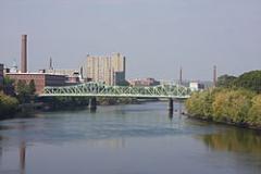
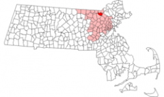
Lowell is a city in Middlesex County, Massachusetts, USA. According to the 2010 census, the city's population was 106,519. It is the fourth largest city in the state. Lowell and Cambridge are the county seats of Middlesex County.
Lowell is known as the cradle of the industrial revolution in the United States and many of the city's historic sites have been preserved by the National Park Service.
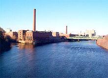
Founded in the 1820s as a planned manufacturing center for textiles, Lowell is located along the rapids of the Merrimack River, 25 miles northwest of Boston in what was once the farming community of East Chelmsford, Massachusetts. The so-called Boston Associates, including Nathan Appleton and Patrick Tracy Jackson of the Boston Manufacturing Company, named the new mill town after their visionary leader, Francis Cabot Lowell, who had died five years before its 1823 incorporation. As Lowell's population grew, it acquired more land from neighboring towns, and diversified into a full-fledged urban center. Many of the men who comprised the labor force for constructing the canals and factories had immigrated from Ireland, escaping the poverty and Potato Famines of the 1830s and 1840s. The mill workers, young single women called Mill Girls, generally came from the farm families of New England.
By the 1850s, Lowell had the largest industrial complex in the United States. The textile industry wove cotton produced in the South. In 1860, there were more cotton spindles in Lowell than in all eleven states combined that would form the Confederacy. The city continued to thrive as a major industrial center during the 19th century, attracting more migrant workers and immigrants to its mills. Next were the Catholic Germans, then a large influx of French Canadians during the 1870s and 1880s. Later waves of immigrants included Portuguese, Polish, Lithuanians, Swedes, and eastern European Jews. They came to work in Lowell and settled in ethnic neighborhoods, with the city's population reaching almost 50% foreign-born by 1900. By the time World War I broke out in Europe, the city had reached its economic and population peak of over 110,000 people.
The Mill Cities' manufacturing base declined as many companies began to relocate to the South in the 1920s. The city fell into deep hard times, and was called a "depressed industrial desert" by Harper's Magazine in 1931, as the Great Depression deepened. More than one-third of its population was "on relief", as only three of its major textile corporations remained active. Several years later, the mills were reactivated, making parachutes and other military necessities for the World War II effort. However, this economic boost was short-lived and the post-war years saw the last textile plants close.
Over the next few decades, the city was just a shadow of itself. In the 1970s, Lowell became part of the Massachusetts Miracle, being the headquarters of Wang Laboratories. At the same time, Lowell became home to thousands of new immigrants, many from Cambodia, following the genocide at the hands of the Khmer Rouge. The city continued to rebound, but this time, focusing more on culture. The former mill district along the river was partially restored and became part of the Lowell National Historical Park, founded in the late 1970s.
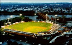
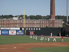
Although Wang went bankrupt in 1992, the city continued its cultural focus by hosting the nation's largest free folk festival, the Lowell Folk Festival, as well as many other cultural events. This effort began to attract other companies and families back to the urban center. Additional historic manufacturing and commercial buildings were adapted as residential units and office space. By the 1990s, Lowell built a new ballpark and arena, which became home to two minor league sports teams, the Lowell Devils and Lowell Spinners. The city also began to have a larger student population. The University of Massachusetts Lowell and Middlesex Community College expanded their programs and enrollment.
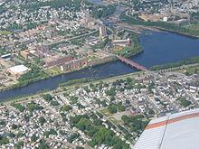
Lowell is located at 42 °38 a²22 a³N 71 °18 a²53 a³W / 42.63944 °N 71.31472 °W / 42.63944; -71.31472 (42.639444, -71.314722). According to the United States Census Bureau, the city has a total area of 14.5 square miles (38 km2).13.8 square miles (35.7 km ²) of it is land and 0.8 square miles (2.1 km2) of it (5.23%) is water.
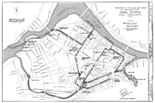
Lowell is located at the confluence of the Merrimack and Concord rivers. The Pawtucket Falls, a mile-long set of rapids with a total drop in elevation of 32 feet, ends where the two rivers meet. At the top of the falls is the Pawtucket Dam, designed to turn the upper Merrimack into a millpond, diverted through Lowell's extensive canal system.
The Merrimack, which flows southerly from Franklin, New Hampshire to Lowell, makes a northeasterly turn there before emptying into the Atlantic Ocean at Newburyport, Massachusetts, approximately 40 miles downriver from Lowell. It is believed that in prior ages, the Merrimack continued south from Lowell to empty into the ocean somewhere near Boston. The glacial deposits that redirected the flow of the river left the drumlins that dot the city, most notably, Fort Hill in the Belvidere neighborhood. Other large hills in Lowell include Lynde Hill, also in Belvidere, and Christian Hill, in the easternmost part of Centralville.
The Concord, or Musketaquid (its original name), forms from the confluence of the Assabet and Sudbury rivers at Concord, Massachusetts. This river flows north into the city, and the area around the confluence with the Merrimack was known as Wamesit. Like the Merrimack, the Concord, although a much smaller river, has many waterfalls and rapids that served as power sources for early industrial purposes, some well before the founding of Lowell. Immediately after the Concord joins the Merrimack, the Merrimack descends another ten feet in Hunt's Falls.
There is a ninety-degree bend in the Merrimack partway down the Pawtucket Falls. At this point, the river briefly widens and shallows. Here, Beaver Brook enters from the north, separating the City's two northern neighborhoods, Pawtucktville and Centralville. Entering the Concord River from the southwest is River Meadow, or Hale's Brook. This brook flows largely in a man-made channel, as the Lowell Connector was built along it. Both of these minor streams have limited industrial histories as well.
The bordering towns (clockwise from north) are Dracut, Tewksbury, Billerica, Chelmsford, and Tyngsboro. The border with Billerica is a point in the middle of the Concord River where Lowell and Billerica meet Tewksbury and Chelmsford.
The ten communities designated part of the Lowell Metropolitan area by the 2000 US Census are Billerica, Chelmsford, Dracut, Dunstable, Groton, Lowell, Pepperell, Tewksbury, Tyngsboro, and Westford, and Pelham, NH. See Greater Lowell.
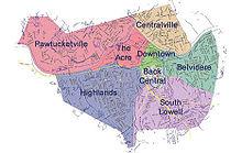
Lowell has eight distinct neighborhoods: the Acre, Back Central, Belvidere, Centralville, Downtown, Highlands, Pawtucketville, and South Lowell. The city also has five ZIP Codes: four are geographically distinct general ZIP Codes, and one (01853) is for post-office boxes only.
The Centralville neighborhood, ZIP Code 01850, is the northeastern section of the city, north of the Merrimack River and east of Beaver Brook. Christian Hill is the section of Centralville east of Bridge Street.
The Highlands is the most populated neighborhood, with almost a quarter of the city residing here, ZIP Code 01851, and is the southwestern section of the city, bordered to the east by the Lowell Connector and to the north by the railroad. Lowellians further distinguish the sections of the Highlands as the Upper Highlands and the Lower Highlands, the latter being the area closer to downtown. Middlesex Village, Tyler Park, and Drum Hill are in this ZIP Code.
Downtown, Belvidere, Back Central, and South Lowell make up the 01852 ZIP Code, and are the southeastern sections of the city (south of the Merrimack River and southeast of the Lowell Connector). Belvidere is the mostly residential area south of the Merrimack River, east of the Concord River, and north of the Lowell and Lawrence railroad. Belvidere Hill is a Historic District along Fairmount Street. Lower Belvidere is the section west of Nesmith Street. Back Central is an urban area south of downtown, toward the mouth of River Meadow Brook. South Lowell is the area south of the railroad and east of the Concord River. Other neighborhoods in this ZIP Code are Ayers City, Bleachery, Chapel Hill, the Grove, Oaklands, Riverside Park, Swede Village, and Wigginsville, but use of those names is mostly antiquated.
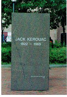
The ZIP Code 01854 is the northwestern portion of the city and includes Pawtucketville; the University of Massachusetts Lowell; and the Acre. Pawtucketville is where Jack Kerouac resided around the area of University Avenue (previously known as Moody Street). The north campus of UMass Lowell is in Pawtucketville. The older parts of the neighborhood are around University Avenue and Mammoth Road, whereas the newer parts are around Varnum Avenue. Middle and elementary schools for this area include Wang Middle School, Pawtucketville Memorial, McAvinnue Elementary School, and private school Ste Jeanne d'Arc. Pawtucketville is the official entrance to the Lowell-Dracut-Tyngsboro State Forest. Pawtucketville's Lowell aeDracut aeTyngsborough State Forest is the probable site of a Native American tribe, and in age of the Industrial Revolution was a prominent source where granite for canals and factory foundations were obtained.
According to the 2010 Census, there were 106,519 people residing in the city. The population density was 7,842.1 people per square mile (2,948.8/km ²). There were 41,431 housing units at an average density of 2,865.5 per square mile (1,106.7/km ²). The racial makeup of the city was 32.8% White, 30.2% Asian American, 6.8% African American, 0.24% Native American, 0.04% Pacific Islander, 6.48% from other races, 3.6% from two or more races. Hispanic or Latino of any race were 27.3% of the population.
Lowell had the second-highest percentage of ethnic Cambodians of any place in the United States, with 10.37% of its population being Cambodian, second only to Long Beach, California. Estimates of the total number of Cambodians living in the city of Lowell range from 11,000 to 25,000-35,000. The Government of Cambodia had opened up its third U.S. Consular Office in Lowell, on April 27, 2009, with Sovann Ou as current advisor to the Cambodian Embassy. The other two are in Long Beach and Seattle, Washington, which also have a large community.
In 2010, there were 38,470 households, and 23,707 families living in Lowell; the average household size was 2.66 and the average family size was 3.31. Of those households, 34.9% had children under the age of 18 living with them, 35.9% were married couples living together, 14.7% had a female householder with no husband present, 38.4% were non-families, 29.4% of all households were made up of individuals, and 8.3% had someone living alone who was 65 years of age or older.
In 2010 the city's population had a median age of 32.6. The age distribution was 23.7% of the population under the age of 18, 13.5% from 18 to 24, 29.4% from 25 to 44, 23.3% from 45 to 64, and 10.1% who were 65 years of age or older. For every 100 females there were 98.6 males; while for every 100 females age 18 and over, there were 97.6 males.
The median income for a household in the city was $50,192, according to the American Community Survey 5-year estimate ending in 2010. The median income for a family was $55,852. Males had a median income of $44,739 versus $35,472 for females. The per capita income for the city was $22,730. About 15.2% of families and 17.5% of individuals were below the poverty line, including 24.5% of those under age 18 and 13.2% of those age 65 or over.
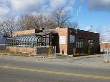
The city of Lowell is primarily policed and protected by the Lowell Police Department, secondarily by the Massachusetts State Police, the UMass Lowell Police, and the National Park Service.
In 2008, the violent crime Rate for Lowell was 1,126.3 per 100,000 of the population, ranking it the 7th most violent city in Massachusetts right ahead of Boston with 1,104 per 100,000. Lowell's crime rate has dropped tremendously since the 1990's
Since 1990, Lowell has averaged about 5 homicides per year with the highest being 13 homicides in 2006. As of 2008, the crime index rating was 446.8. The national average was 320.9. Lowell has been locally notorious over the years for being a place of high drug trafficking and gang activity. The Lowell Police Department has made positive progress in bringing the crime rates down in recent years. In the years from 1994 to 1999, crime dropped 50 percent, the highest rate of decrease for any city in America with over 100,000 residents. In 2009, Lowell was ranked as the 139th most dangerous city of over 75,000 residents in the United States, out of 393 communities. Out of Massachusetts cities, nine are larger than 75,000 residents, and Lowell was fifth most dangerous or safest. For comparison Lowell is rated safer than Boston (104 of 393), Providence RI (123), Springfield (51), Lynn (120), Fall River (103), and New Bedford (85), but rated more dangerous than Cambridge (303), Newton (388), Quincy (312), and Worcester (175).
Among the many tourist attractions, Lowell also currently has 39 places on the National Register of Historic Places including many buildings and structures as part of the Lowell National Historical Park.
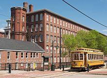
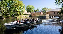
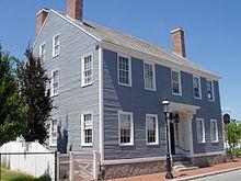
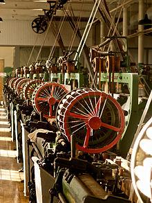
In the early years of 1840's when the population quickly exceeded 20,000, Lowell became very active as a cultural center, with the construction of the Lowell Museum, the Mechanics Hall, as well as, the new City Hall used for art exhibits, lectures, and for the performing arts. The Lowell Museum was lost in a devastating fire in the early morning of January 31, 1856, but was quickly rehoused in a new location. The Lowell Art Association was founded in 1876, and the new Opera House was built in 1889.
Continuing to inspire and entertain, Lowell currently has a plethora of artistic exhibitions and performances throughout a wide range of venues in the city:
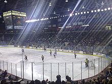
On April 1, 2006, Lowell held the 2006 World Curling Championships for the men's teams at the Tsongas Center at UMass Lowell.
Lowell has a Plan E form of council-manager government. There are nine city councilors and six school committee members, all elected at large in a non-partisan election. The City Council chooses one of its members as mayor, and another as vice-mayor; the mayor serves as chair of the council and school committee, and performs certain ceremonial duties. As of January 2012, the members of the Lowell School Committee are Mayor Patrick Murphy, Vice Chair David Conway, Robert J. Gignac, James Leary, Connie Martin, Kimberly Scott and Kristin Ross-Sitcawich. The administrative head of the city government is the City Manager, who is responsible for all day-to-day operations, functioning within the guidelines of City Council policy, and is hired by and serves at the pleasure of the City Council as whole. As of January 2012, the City Manager is Bernard F. Lynch.
Lowell is represented in the Massachusetts General Court by State Representatives Thomas Golden, Jr. (16th Middlesex 1995 to Present), David Nangle (17th Middlesex 2000 to Present) and Kevin Murphy (18th Middlesex 1996 to Present), and by State Senator Eileen Donoghue (1st Middlesex), all of whom are Democrats. Federally, the city is part of Massachusetts's 5th congressional district and represented by Democrat Niki Tsongas. The state's senior member of the United States Senate is Democrat John Kerry, elected in 1984. The state's junior member of the United States Senate is Republican Scott Brown was elected in 2010 to fill the vacancy caused by the death of long-time Democratic senator Ted Kennedy.
Lowell Public Schools operates district public schools. Lowell High School is the district public school. Non-district public schools include Greater Lowell Technical High School, Lowell Middlesex Academy Charter School, Lowell Community Charter Public School.
Lowell Catholic High School, est. 1989, is in Lowell.
Private grade schools include:
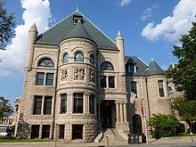
The first Lowell public library was established in 1844 with 3,500 volumes, and was set up in the rooms of the Old City Hall. About 30 years later the expanding collection was relocated across the street to the Masonic Temple In 1890-91, the City of Lowell hired local Architect Frederick W. Stickney to design the new Lowell City Library, known as "Memorial Hall, in honor of the city's men who lost their lives in the American Civil War. In 1981, the library was renamed the Pollard Memorial Library in memory of the late Mayor Samuel S. Pollard. And, in the mid 2000's the century old National Historic building underwent a major $8.5m renovation. The city also, recently expanded the library system to include the Senior Center Branch, located in the City of Lowell Senior Center.
In fiscal year 2008, the city of Lowell spent 0.36% ($975,845) of its budget on its public libraries, which houses 236,000 volumes, and is a part of the Merrimack Valley Library Consortium. Currently, circulation of materials averages around 250,000 annually, with approximately one-third deriving from the children's collection. In fiscal year 2009, Lowell spent 0.35% ($885,377) of its budget on the library aesome $8 per person.
As of 2012, the Pollard Library purchases access for its patrons to databases owned by: EBSCO Industries; Gale, of Cengage Learning; Heritage Archives, Inc.; New England Historic Genealogical Society; OverDrive, Inc.; ProQuest; and World Trade Press.
The Lydon Library is a part of the University of Massachusetts Lowell system, and is located on the North Campus. The building is named in honor of President Martin J. Lydon, who's vision expanded and renamed the college, during his tenure in the 1950s and 1960s. Its current collection concentrates on the sciences, engineering, business management, social sciences, humanities, and health.
The O'Leary Library is a part of the University of Massachusetts Lowell system, and is located on the South Campus. The building is named in honor of former History Professor and then President O'Leary, who's vision helped merge the Lowell colleges, during his tenure in the 1970s and 1980s. Its current collection concentrates on music and art.
The Center for Lowell History is a part of the University of Massachusetts Lowell system, and is located downtown Lowell. Its current collection concentrates on the history of Lowell, the Boston & Maine Railroad, and the history of the University of Massachusetts Lowell.
The Sun, headquartered in downtown Lowell, is a major daily newspaper serving Greater Lowell and southern New Hampshire. The newspaper had an average daily circulation of about 42,900 copies in 2011. Continuing a trend of concentration of newspaper ownership, The Sun was sold to newspaper conglomerate MediaNews Group in 1997 after 119 years of family ownership.
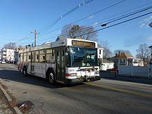
Lowell can be reached by automobile from Interstate 495, US Route 3, the Lowell Connector, and Massachusetts Routes 3A, 38, 110, 113, and 133. There are six bridges crossing the Merrimack River in Lowell, and four crossing the Concord River (not including the two for 495).
For public transit, Lowell is served by the Lowell Regional Transit Authority, which provides fixed route bus services and paratransit services to the city and surrounding area. These connect at the Gallagher Transit Terminal to the Lowell Line of the MBTA commuter rail system, which connects Lowell to Boston. The terminal is also served by several intercity bus lines.
The Lowell National Historical Park provides a free streetcar shuttle between its various sites in the city center, using track formerly used to provide freight access to the city's mills.
See List of People from Lowell, Massachusetts
The city is the subject of Death Cab for Cutie's song, "Lowell, MA," from their album We Have the Facts and We're Voting Yes.
The city was also featured in the song "Lowell Man" by Tom Doyle. Doyle, of WROR-FM 105.7 in Boston, does many songs like this spoofing classic rock by rewording them to make fun of various things about New England ("Lowell Man" is a spoof of "Soul Man" by Sam & Dave).
The Dropkick Murphys' Warrior's Code tells story of Lowell Boxer Micky Ward, mentioning Lowell and several city facts in the song.
James Taylor's song "Millworker" is about a woman living in Lowell.
Tom Waits references the city on the album Small Change in the track "Bad Liver and a Broken Heart (In Lowell)".
Pop punk band Boys Like Girls hail from Lowell, Massachusetts.
Lowell has also been the subject of a number of novels. Some of the better known ones are:
Word Count: 4234


